Atlas 14 IDF regionalization
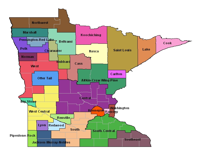
To assist in using Atlas 14 with the Rational Method, MnDOT has created 32 Atlas 14 Rainfall Intensity-Duration-Frequency (IDF) Regions, as shown in the map below. These regions supersede the 3 regions specified in the MnDOT Drainage Manual (2000). These tables were designed to be used with the Rational Method which is typically used for storm drain design and catch basin spacing. Open the Index of Minnesota Counties with Assigned Atlas 14 Regions document (PDF), navigate to the county of interest, and then select the appropriate regionalized IDF data.