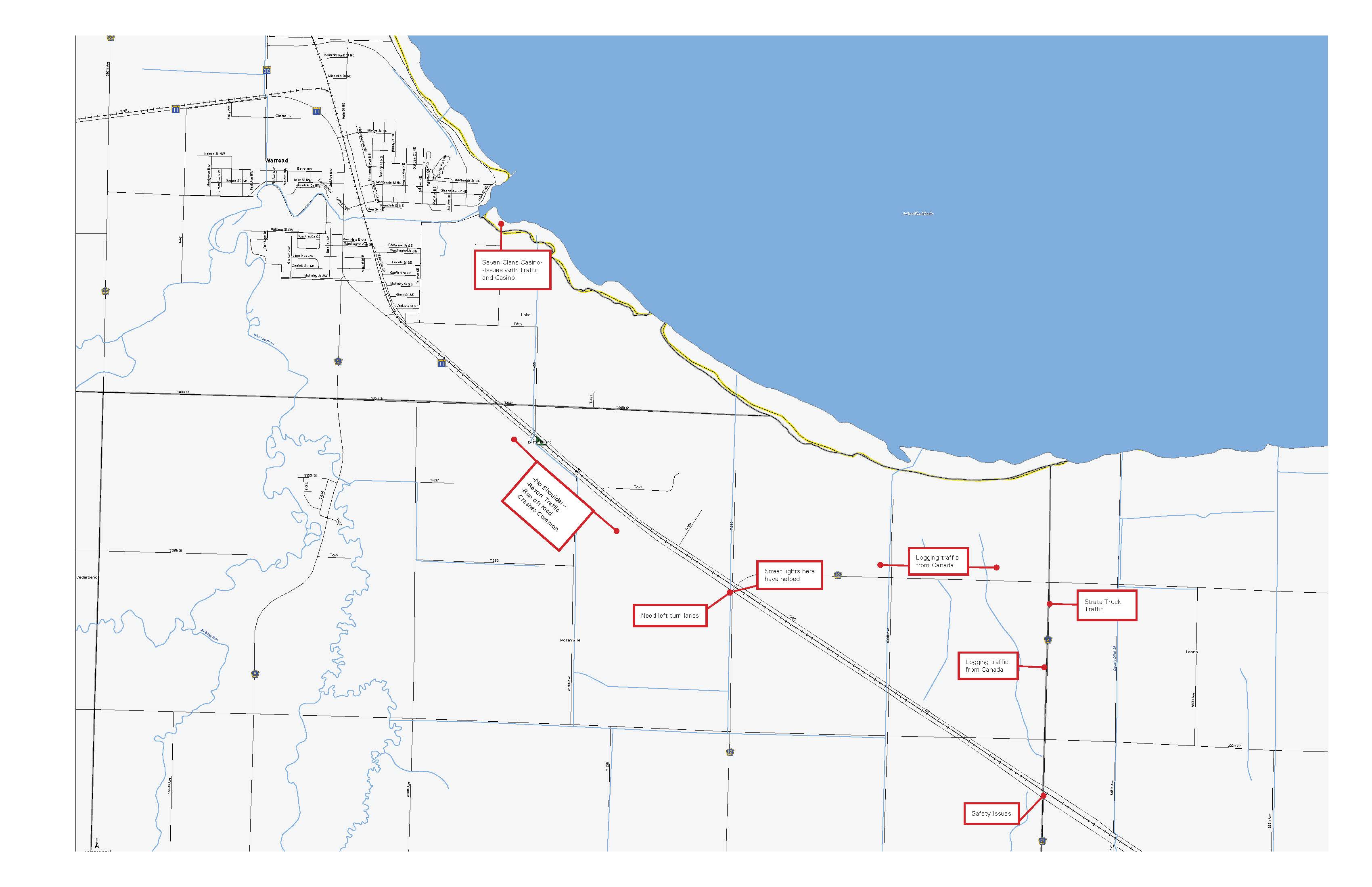
Warroad
Area 6: West of Warroad
Limits: Hwy 11 between 440th Avenue and Hay Creek
Primary Improvement: Construct passing lanes on Hwy 11 to create a super-two roadway
Number of Alternatives: 4
Problem Alternative is Addressing: Community desire for more passing opportunities between Roseau and Warroad.
Option A: Super-two roadway with eastbound passing lane between 450th Avenue and Hay Creek
Description: Expand Hwy 11 to a super-two roadway between 450th Avenue and Hay Creek.
- Eastbound passing lane for 1.25 mile
- East and westbound left and right turn lanes at Cty Rd 9/460th Avenue
Estimated Construction Costs: $1,200,000-$1,500,000
Right of Way Needs: None.
Environmental Concerns: None identified.
Risks: Safety concerns due to passing lane extending through Cty Rd 9. Skew at TH 11 and Cty Rd 9 intersection.
Benefits: Safety and mobility improvements:
- Passing lanes
- Turn lanes
Option B: Super-two roadway with eastbound passing lane on new roadway alignment between 440th Avenue and Hay Creek
Description: New roadway alignment between 440th Avenue and Hay Creek, following an abandoned railroad bed
- Eastbound passing lane for 1 .5 miles
- Realign Cty Rd 9/460th Street intersection
- Mitigate trail in new right of way
Estimated Construction Costs: $7,000,000-$8,000,000
Right of Way Needs: 2 miles of former railroad right of way from the Roseau County Trailblazers. Additional right of way from up to 13 parcels.
Environmental Concerns: Relocate existing ATV/snowmobile trail.
Risks: Right of way acquisition and mitigation for the trail.
Benefits: Safety and mobility improvements:
- Passing lanes
- Turn lanes
- Reduced access onto Hwy 11
Option C: Super-two roadway with staggered east and westbound passing lanes on new roadway alignment between 440th Avenue and Hay Creek
Description: New roadway alignment between 440th Avenue and Hay Creek, following an abandoned railroad bed
- Staggered passing lanes: eastbound passing lane for 0.8 mile, westbound passing lane for 0.8 mile
- Realign Cty Rd 9/460th Street intersection
- Mitigate trail in new right of way
Estimated Construction Costs: $7,000,000-$8,000,000
Right of Way Needs: 2 miles of former railroad right of way from the Roseau County Trailblazers. Additional right of way from up to 13 parcels.
Environmental Concerns: Relocate existing ATV/snowmobile trail.
Risks: Right of way acquisition and mitigation for the trail. Length of passing lane is not ideal – would prefer to have a mile.
Benefits: Safety and mobility improvements:
- Passing lanes
- Turn lanes
- Reduced access onto Hwy 11
Option D: Four-lane roadway on new alignment between 440th Avenue and Hay Creek
Description: New roadway alignment between 440th Avenue and Hay Creek, following an abandoned railroad bed
- Four-lane roadway between existing Hwy 11 and Cty Rd 9 (1.5 miles)
- Realign Cty Rd 9/460th Street intersection
- Mitigate trail in new right of way
Estimated Construction Costs: $8,000,000-$9,000,000
Right of Way Needs: 2 miles of former railroad right of way from the Roseau County Trailblazers. Additional right of way from up to 13 parcels.
Environmental Concerns: Relocate existing ATV/snowmobile trail.
Risks: Right of way acquisition and mitigation for the trail. Four-lane roadways have higher crash rates than other road design types – access has to be controlled to the roadway to minimize that risk.
Benefits: Safety and mobility improvements:
- Passing lanes
- Turn lanes
- Reduced access onto Hwy 11
Concept layouts
Area 6, Option A
Area 6, Option B
Area 6, Option C
Area 6, Option D