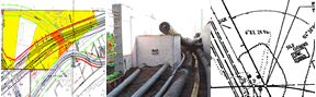
Photogrammetry & Remote Sensing
Photogrammetry is the art, science, and technology of obtaining reliable information about physical objects, the environment and terrain, through processes of recording, measuring and interpreting stereoscopic aerial images.
Remote sensing is a set of techniques and tools used to gather and process information about an area of land or object without direct physical contact.
Photogrammetry and remote sensing in transportation have long been recognized as an efficient and effective method for increasing engineering production at all levels.
Products and services
- Vertical aerial photography, digital multi-spectral imagery and remote sensing data acquisition in coordination with district survey personnel and private partners
- Analytical Aero-Triangulation Solutions
- Planimetric Feature Compilation
- Digital Elevation Model (LIDAR) Production
- Digital Terrain Model Compilation
- Orthophoto Production
- Private Partner Consultant Contract Management for Photogrammetric and Remote Sensing products and services
To request services, please complete the Photogrammetry and Remote Sensing Services form.
Specifications and reports
- Mapping feature specifications (PDF 24 MB)
- Aerial photography specifications
- Cooperative county map accuracy reports
Publications
- GPS/RTK Accuracy & Procedure Report (PDF 2.5 MB)