Future vision
Visual layouts show future Hwy 210 segments—west, bridge, downtown, railyard, mall and east—when complete in 2027. Use drop-down menu to learn more.
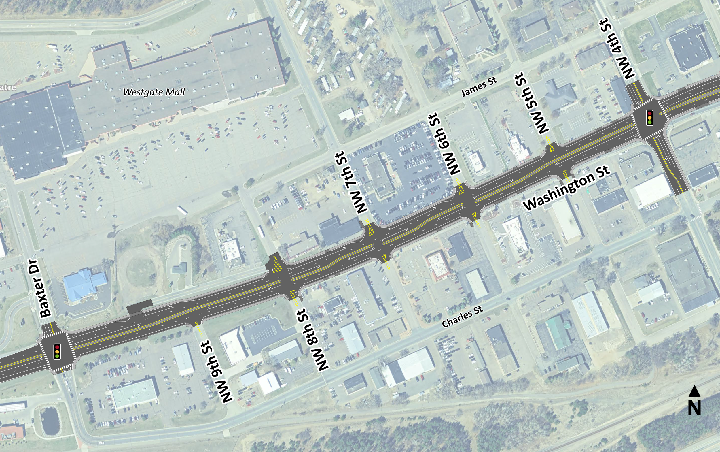
Hwy 210—Baxter Dr. to NW 4th St.
- Resurface road
- Update concrete median
- Update/widen sidewalk and road approaches
- Update storm sewer
- Replace signal at Baxter Dr.
- Update access at NW 5th St.
- New, wider sidewalks
- Map of west segment location (PNG)
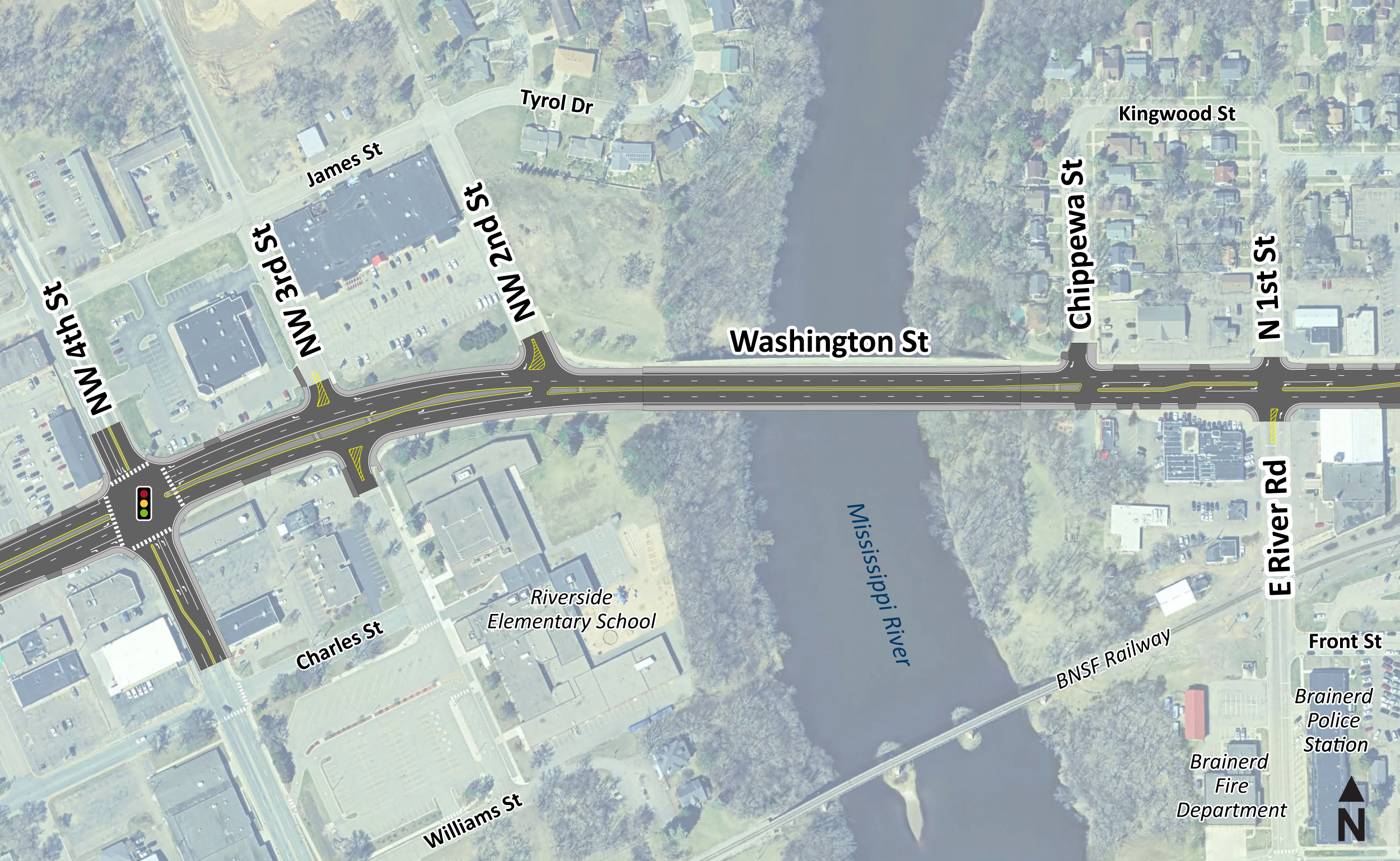
Hwy 210—4th St. to east E River Rd.
- Reconstruct road, includes entrances
- Replace signal at Hwy 210 and NW 4th St.
- Update Mississippi River bridge, includes bridge approaches
- Install city watermain under Hwy 210
- Install storm sewer outlets at the river
- Reconstruct wider sidewalk
- Location map of bridge segment (PNG)
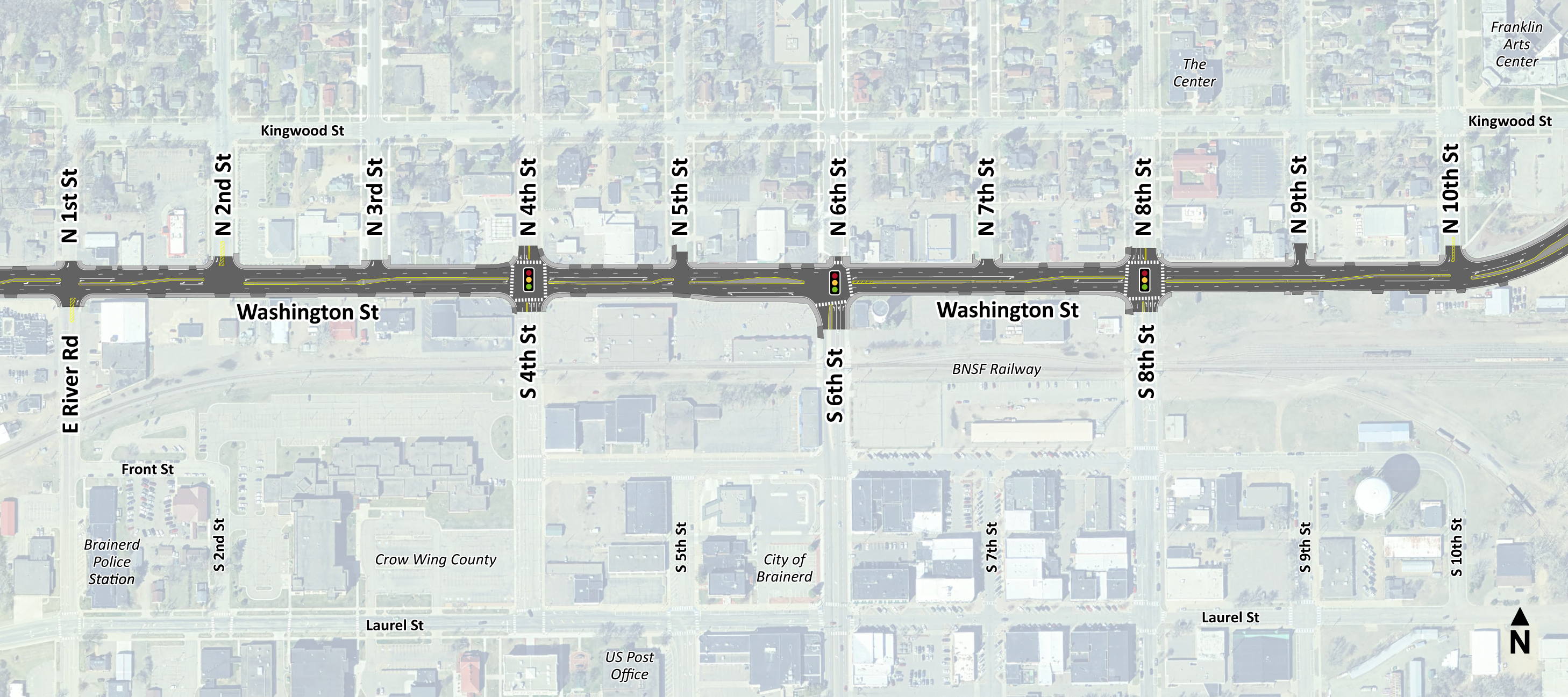
Hwy 210—E River Rd. to Kingwood St.
- Reconstruct road surface, includes entrances
- Install concrete median to improve and modify Hwy 210 access at:
- N 3rd St., N 5th St., N 7th St., N 9th St. and 10th St N.
- Replace signal at Hwy 210 and 4th St.
- Update signal at Hwy 210 and Hwy 371B/S 6th St.
- Replace signal at Hwy 210 and 8th St.
- Install city watermain under Hwy 210
- Install storm sewer
- Construct wider sidewalk
- Location map of downtown segment (PNG)
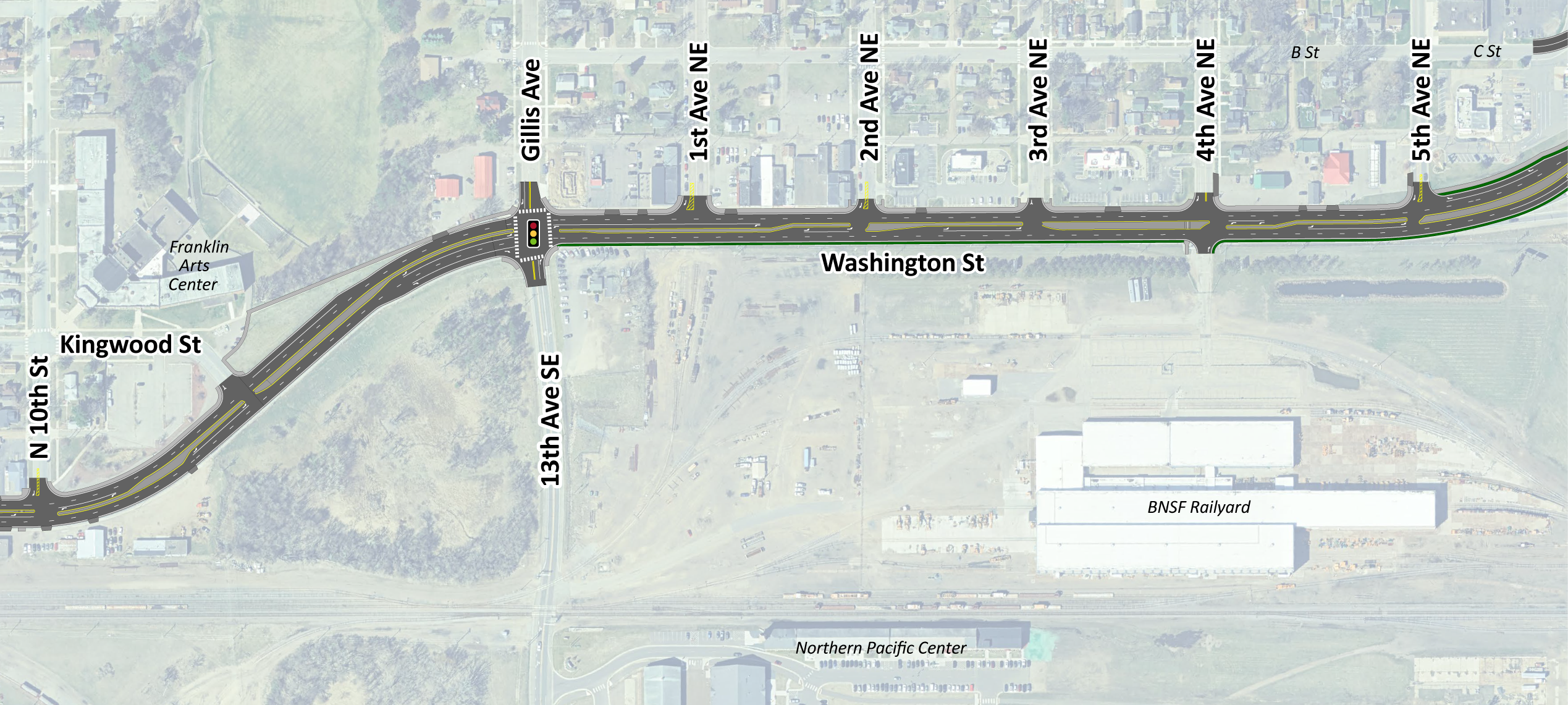
Hwy 210— Kingwood St. to 5th Ave. NE
- Reconstruct road and adjacent entrances
- Remove signal at Hwy 210 and 4th Ave. NE
- Replace signal at Hwy 210 and 13th Ave. SE/Co. Rd. 45/Gillis Ave.
- Install concrete median to improve and modify Hwy 210 access at:
- 1st Ave. NE., 2nd Ave. NE. and 4th Ave. NE
- Install city watermain beneath Hwy 210
- Reconstruct wider sidewalk and road approaches
- Location map railyard segment (PNG)
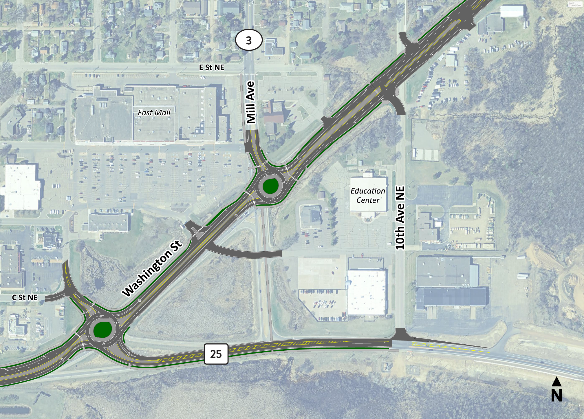
Hwy 210—5th Ave. NE to 10th Ave. NE
- Reconstruct road, concrete medians and adjacent entrances
- Construct two roundabouts and local accesses in between
- Hwy 210 at Hwy 25 and C St. (four legs)
- Hwy 210 at Mill Ave./Co. Rd. 3 (three legs)
- Reconstruct Hwy 210 connections at Hwy 25 (C St./Hwy 210 roundabout) and 10th Ave. NE
- Install city watermain underground along Hwy 210
- Install sidewalks and Cuyuna Trail connections
- Location map of mall segment (PNG)
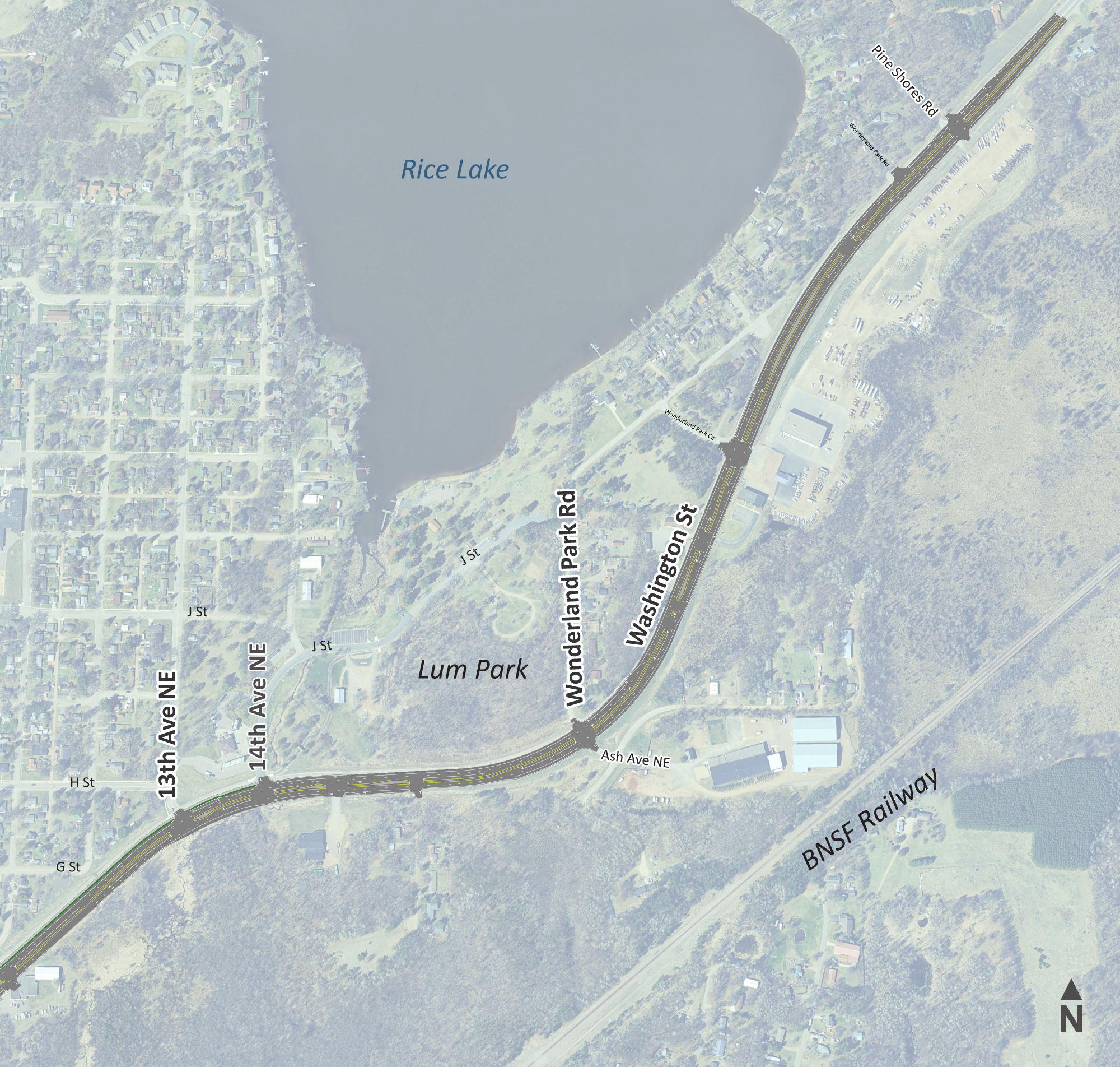
Hwy 210—10th Ave. NE to Pine Shores Rd.
- Resurface road
- Replace concrete median
- Install or add sidewalk/Cuyuna Trail
- Resurface, repair and update 14th Ave.NE/J St.access at Lum Park, includes underground drainage repairs
- Location map of east segment (PNG)
Note: Visual layouts are representative only. Information is subject to change. Aerial images will not match drawn lines perfectly. MnDOT March 2025.
