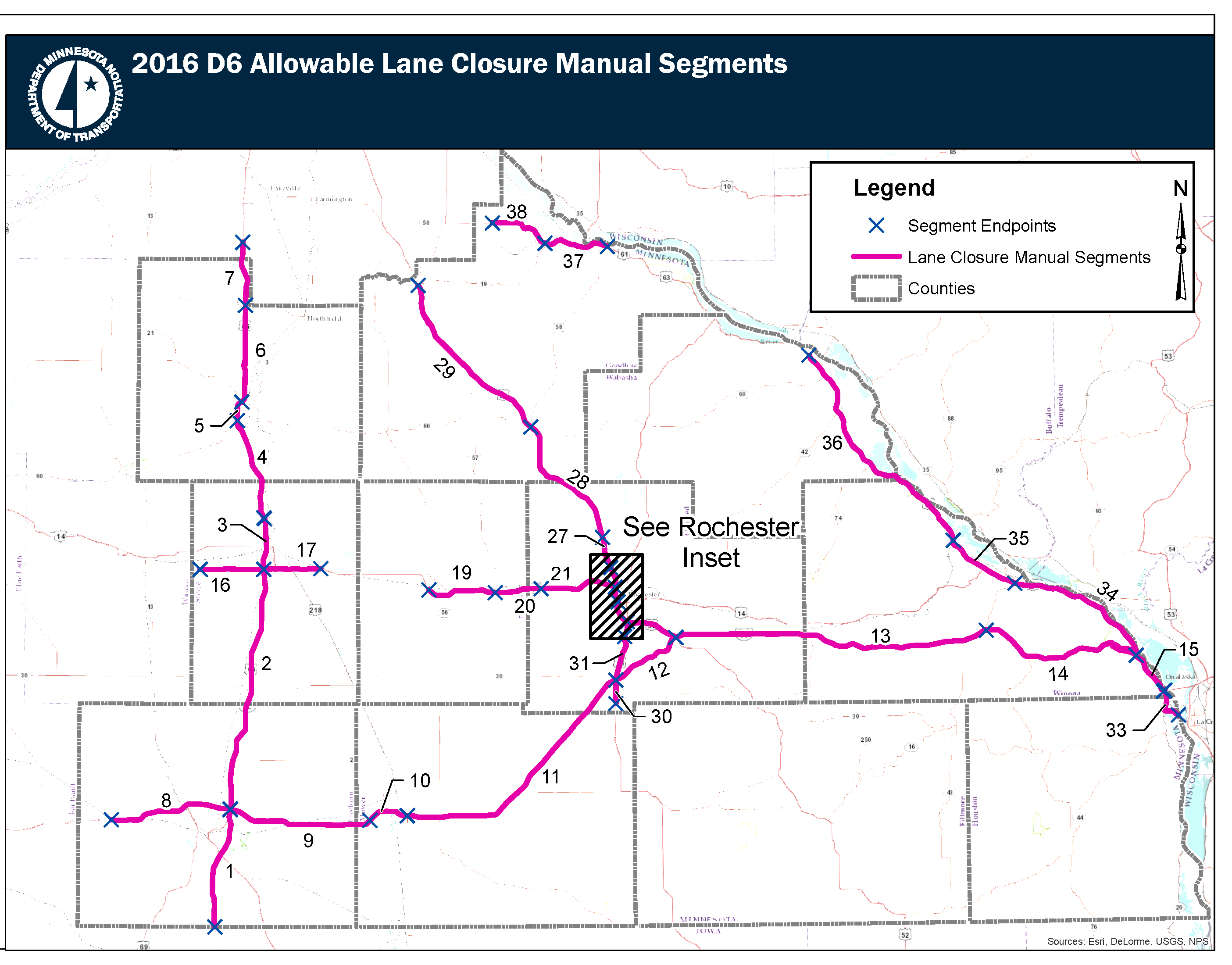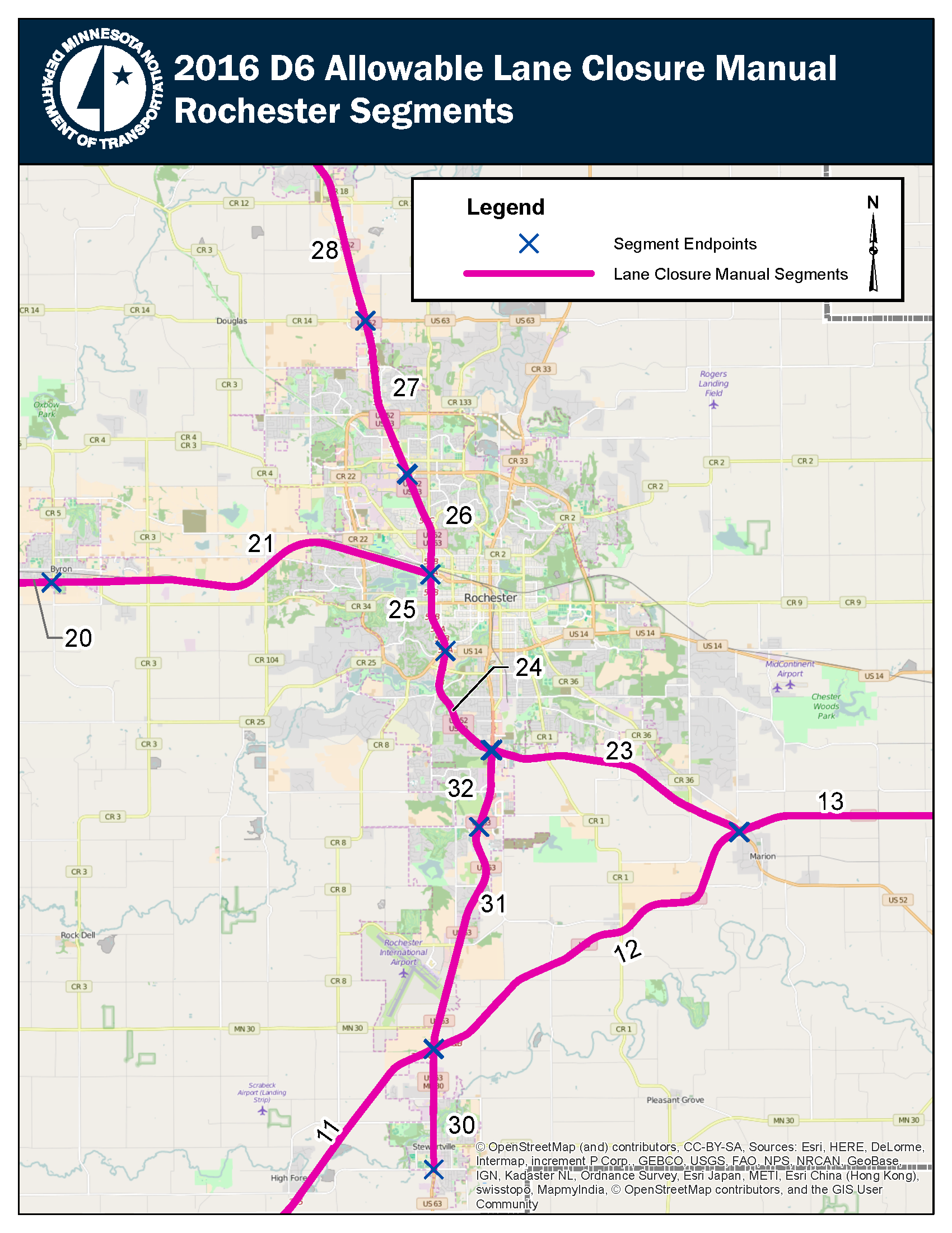
Background
This Allowable Lane Closure Manual is used when planning and scheduling lane and shoulder closures on MnDOT owned and operated freeways and expressways in District 6. When planning a lane closure check if the closure is allowed during the desired time of day. Effort should be made to schedule closures during the hours allowed. If a lane closure is not allowed during the hours needed to complete the work contact District 6 traffic to discuss. For information on Metro District roadways please see the Metro District Allowable Lane Closure Manual.
Guidance
Lane closures allowed by this manual are typically short term (12 hours or less) and will not divert or detour traffic. Advance notice signs (installed days in advance of a closure/project) are not typically required for lane closures allowed by this manual. If a requested lane closures overlaps two or more adjacent report segments, please use the most restrictive report segment. For those who have not used the lane closure manual before here is a short “how to” and example.
This manual is not intended to apply to emergency road maintenance and repairs that must be performed without planning. The judgment of field staff and necessity of the situation should determine the course of action in emergency situations.
The Temporary Traffic Control Field Manual from the Minnesota Manual of Uniform Traffic Control Devices (MnMUTCD) provides information on typical traffic control layouts, which may be used during a lane closure. The typical layouts contained in the Temporary Traffic Control Field Manual do not cover all situations. Because all situations differ, engineering judgment should be used to insure proper traffic control. The goal of temporary traffic control is to provide for the safe and efficient movement of traffic around the lane closure and in any location where the normal function of the roadway is temporarily suspended.
Purpose of the manual
The purpose of the Allowable Lane Closure Manual is to provide information useful for advance planning of lane closures that will minimize traffic impacts and motorist delays while promoting safety for work crews and the traveling public. This Allowable Lane Closure Manual covers MnDOT owned and operated expressways and freeways, within the District 6.
Traffic congestion and backups may contribute to the cause of crashes and motorist delays. Traffic management practices that attempt to reduce congestion have a documented positive effect on crash rates, motorist travel times, and travel time reliability. Planned lane closures that do not cause a traffic flow "bottleneck" will cause only minor to moderate levels of congestion and backup and are an effective traffic management strategy.