Drones are aircraft
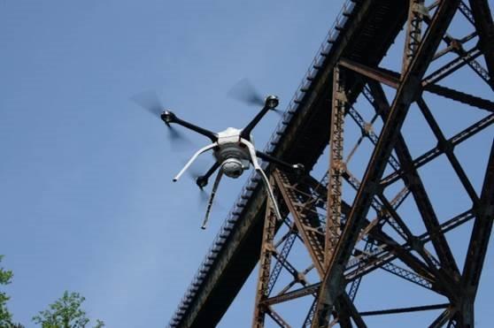
All aircraft are subject to federal and state regulations
Technical literature may call drones: Uncrewed Aerial Systems (UAS), Remotely Piloted Vehicles, Autonomous Aircraft, or Model Aircraft. Regardless of what they are called, drones are any devices capable of controlled flight that do not have a pilot onboard.
Aircraft registration
MnDOT is the state-level regulator for aircraft in Minnesota.
MnDOT Aeronautics has prepared specific pages with information based on how you, your company, or your government agency operates or interacts with drones.
What are your intentions with a drone?
Drone airport inspection makes for clearer takeoffs, landings
by Joseph Palmershiem
In aviation, every takeoff is optional – but every landing is mandatory.
MnDOT’s airport drone inspection program makes landing a little easier. The agency uses drones to look for approach and departure obstructions: trees, power poles, roads or anything that would impact flight paths. The drones use LIDAR (determining ranges by measuring the time it takes for laser beams to travel and return to the optical receiver) and collect elevation data at 132 airports across the state.
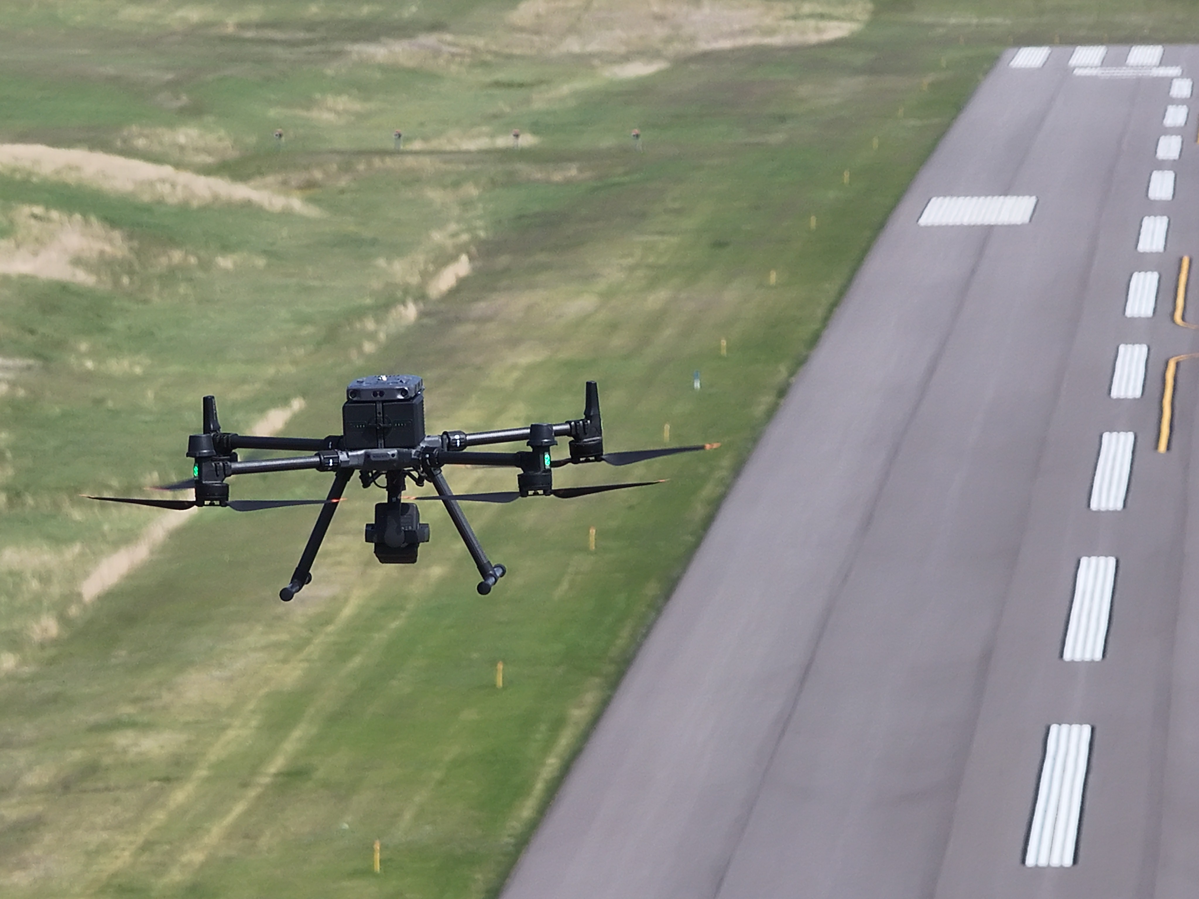
“Prior to this, we used GPS and laser range finders, and we were limited by what surveyor could see,” said Nate Williams, UAS coordinator. “With up-to-date maps and up-to-date obstruction information, you are getting the whole picture of things with this drone-based reality capture. It’s safe, it reduces the amount of time we need to spend out at airports, and we can provide data to our partners that is very visual and picture focused.”
Trees and brush are the most common obstructions, which makes sense, Williams noted, because they grow and change over time. Other findings don’t – sometimes a road can be 10 feet off course due to bad survey data. Solutions depend on the problem. Sometimes, its trimming trees. Other times, it’s adjusting the paint at the end of the runway.
MnDOT also uses drones to check approach alignment tools for accuracy. The Visual Approach Slope Indicator (VASI) and Precision Approach Path Indicator (PAPI) systems can tell a pilot if their aircraft is on, above, or below the correct glide path. A glide path is the correct angle a plane needs to be at for a smooth, controlled landing approach.
Prior to using drones for this, alignment required booking special FAA airplanes to come in and verify the accuracy of the VASI and PAPI systems. Now, drones can provide the same information by using rangefinders and GPS. The drones can also create large-scale imagery of the entire airport, too, Williams said.
“We can use drones to create 3-D models of airports and heliports,” he said. “Our airport partners can use this when they are looking to add new buildings. Prior to this, it would cost up to $15,000 to have these models made. Now, we can provide it when we are already out there. It’s an inexpensive value-add. It saves airports a bunch of money, and the grants they get go further due to not having to spend money out of pocket on this imagery.”
Future plans for the airport drone inspection program could include more heliports. Drones could create 3-D visuals of approach and departure paths for medical helicopters.
“We can show exactly where they should approach and depart,” Williams said. “It’s safer and much easier.”
Photogrammetric drones raise access, lower costs to map imagery
by Joseph Palmershiem
They pop up each spring like dandelions – white crosses and chevrons on the ground, serving as markers for aerial mapping.
But while that crop of temporary markers is the same, taking pictures of them is different than it was 10 years ago. It used to be entirely done by airplanes – now, some of the work is done by MnDOT drones.
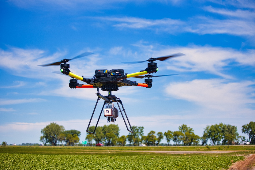
MnDOT’s Office of Land Management has four drone pilots and nine drones. They use aerial imagery and sensor data to create a variety of maps and other forms of planimetric (two-dimensional representation of features and objects) imagery. While online services can offer maps, the level of detail MnDOT is able to capture exceeds what is available for free to the public, said Colin Lee, photogrammetric mapping supervisor.
The advantages are pretty straightforward. Getting this imagery with a drone is easier and faster, with similar data quality. A drone can fly a mission for less than a third of the costs of what it would take to do a traditional survey. That said, economy of scale limits the drones to projects that are less than two miles long.
“Those costs are much smaller than using an airplane,” Lee said. “It can cost thousands of dollars to just to get an airplane here. The other thing we're finding is that we've really expanded the growth. There are a lot of offices that couldn’t cover the cost of getting this data before. Now that costs are reduced, they can get those products and services. One of the biggest things has been working with tribal partners. Using drones keeps boots off the ground in culturally sensitive areas. We can fly and map those areas without anyone walking there.”
These outcomes have their roots in a 2015 partnership between MnDOT and a Minnesota county. A consultant there had built a drone with a camera on it, and the data helped convince senior MnDOT leadership that it was worth exploring further. Land Management got its first drone later that year.
“It was exciting,” Lee recalls. “We like having a problem to solve, and this was a whole new look on the same problems that we'd been solving for years. All the issues from large-scale mapping were all condensed into the micro scale. A drone is a less stable platform than a fixed-wing aircraft, and the cameras then were off the shelf. We had to figure out heat, humidity, environmental factors and how they changed the lens. Software wasn't made for this at the time either. We were plugging our data into traditional software and figuring out how to get a product off that. It was fun and really rewarding.”
The result was a full UAS mapping and survey program with dedicated staff. It's not just a supplement to something else, Lee noted.
“We’re out of the ‘disruptive’ stage,” he said. “Drones are becoming an accepted technology. It was the Wild West out there when we first started. It's entering maturity. Our UAS growth isn't done yet. The customer base can still expand. We'll continue to upgrade, technology-wise. We've been very lucky to have support from leadership in this. None of this could be done without support. We have a stellar team that makes it easy - folks that are engaged and want to see this succeed.”
Bridge inspection drones give an up-close look at Minnesota bridges
By Joseph Palmersheim
With over 20,000 bridges on both the state and local system, inspectors are always busy.
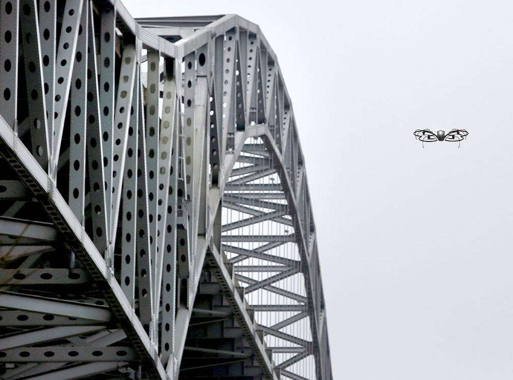
For almost 11 years now, that work has been made easier thanks to drone technology. Crews can get an up-close look decking the bridge deck, beams, bearings, and everything in between – work that typically requires a special snooper truck and potential lane closures. There are more than 30 pilots at MnDOT that fly a fleet of 46 drones, using photography and thermal scans to get an up-close look at each bridge.
A lot has changed since the program started in 2015. Back then, the FAA had yet to come up with its drone flight rules.
“It’s a just a toy with a camera and it will be fun, right?” Jennifer Randall, state bridge inspection engineer, recalls thinking at the time. “We went into this so naïve. Luckily, MnDOT’s Aeronautics department stepped in to assist. Commercial drone use by the state was new to them then as well. We had to go all the way to the governor’s office for approval to start our research in using drones for bridge inspection in 2015.”
A pilot program focused on four different test bridges in rural areas. MnDOT acquired most of its bridge inspection drone fleet via federal grants in 2018. The fleet has expanded since then, and a generation of MnDOT workers raised on video games has found a new outlet for quick thumbs.
In addition to greater inspection flexibility, the inspection drones are also cheaper to operate. They offer safety improvement by limiting work zone closures and working from heights or enclosed spaces.
“These drones work best on bridges over water,” Randall said. “Vegetation can be a problem. The drones have obstacle avoidance sensors, and no matter what you do it won’t hit the bridge. We can get really close.”
Some of the drones carry thermal cameras that can detect concrete delamination on bridge decks. Delamination is when the top layer of concrete detaches from the layer below.
“Concrete is cold in the morning, and as it heats up, infrared can detect the unsound material areas by the heat difference,” Randall said. “Affected areas are hotter. You can see the difference between the sound and unsound concrete.”
Drones can also be used to capture imagery and data from flooding scenarios, like at the Rapidan Dam in Mankato in 2024. Less dramatic but still useful are images of the same bridge collected over time – these can show how water affects a bridge over the course of years.
Future plans for the bridge inspection drones call for more use of AI inspection software that can detect and quantify cracks in concrete. Drones have been used and will continue to be used to develop 3-D models of Minnesota bridges.
“These drones have improved the quality of our inspection data,” Randall said. “If you can use a drone for even a portion of this work, you can really reduce the size of a work zone or eliminate it by getting photos and data that way. A lot of times, what these drones can get, image-wise, is better than our own eyesight.”
A peek and a spritz: MnDOT drone programs help drain inspection, herbicide application
By Joseph Palmersheim
Did you know that MnDOT drone pilots logged more than 1,000 flight hours in 2025?
The agency’s 58 pilots made 648 flights that year. MnDOT uses drones for a wide variety of tasks. Staff use them to inspect bridges, do surveying and map making, take photos, and more. From spotting stormwater drains in hard-to-reach places to literally getting into the weeds, two fairly new drone programs are finding ways to get the job done faster, safer, and more efficiently.
Water and fire
MnDOT’s Water Resource unit started using drones last year. “Stormwater” is water that leaves MnDOT Right of Ways via sewer or pipes (“outfalls”) before discharging into another water body. The agency is required to inspect a percentage of those outfalls and stormwater ponds each year. Due to their nature, these aren’t always easy to get to. There are sometimes cliffs or rocky terrain, and vegetation can sometimes be so dense that crews can’t get thought it.
With a drone, it can be a lot easier, explained Kyle Uhlen, wetland specialist. He flew drones for five years before joining MnDOT. One of his notable use cases last year came from trying to find a hard-to-access outfall on Pig’s Eye Lake.
“I was able to use thermal imagery from the drone’s camera to see where the cold water was coming out, and that was able to tell us where the outfall was,” he said. “We didn’t have to walk over because we could just fly in the airspace. Prior to using a drone, that would have taken coordination with city and railroad to access the property. It took us minutes with the drones.
The thermal cameras are useful in other cases, too:
- They help with the department’s prescription burns. Pre-set temperature alarms can find hotspots that need to be extinguished after a fire line passes through. The camera also gives burn bosses an extra perspective from above that can see through smoke. Finally, it can track people as they move on the worksite, allowing fire bosses to know who is where, and when.
- Thermal cameras can spot illegal dumping (“illicit discharge”) in MnDOT Right of Ways. If warm water is spotted leaving a pipe, and there hasn’t been any rain, chances are good that someone put it there – illegally.
One of the biggest advantages of using drones for WRE’s work is safety. Being able to fly keeps staff out of challenging or potentially harmful situations.
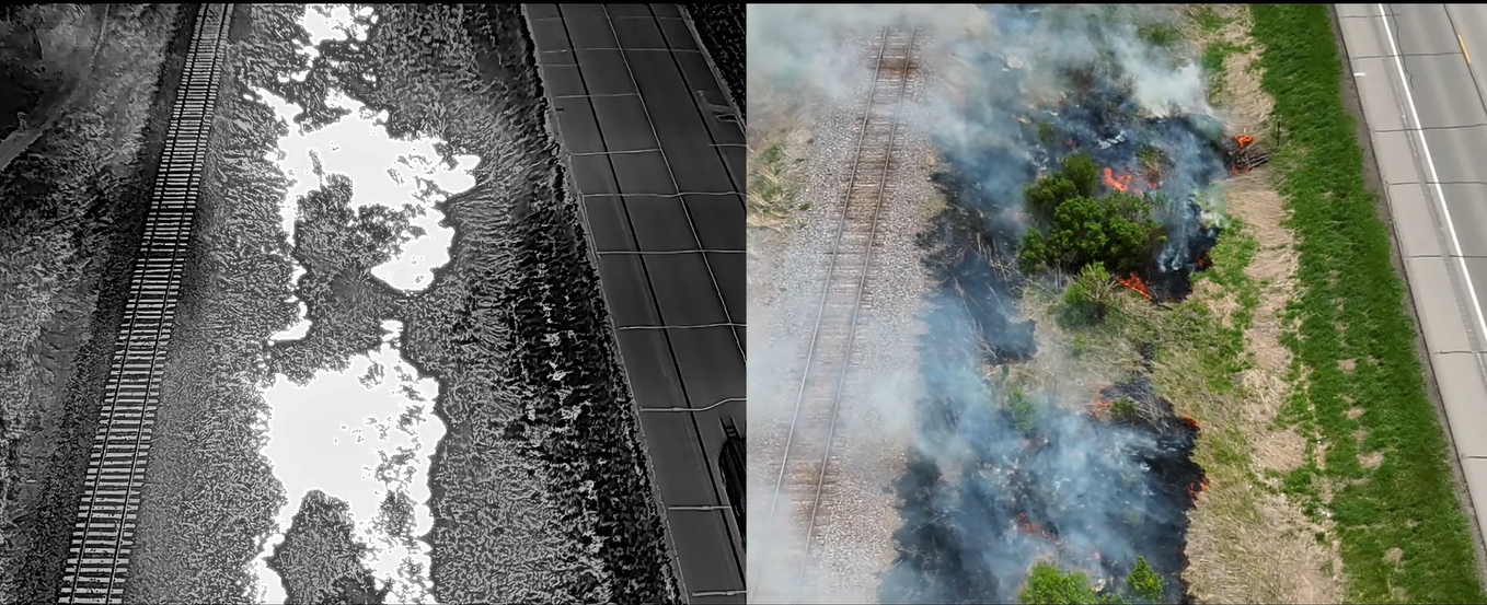
“It helps us prioritize the inspection sites in the sense that you can take off, look at it, and decide if you actually need to go in on foot,” he said. “It’s a huge time saver, especially on a high heat index day. If we can get more sites in on a hot day, without the physical exertion, it’s more effective and safer.”
Lee Daleiden, stormwater asset coordinator, agreed with the safety aspect, saying that using a drone was much easier than having to navigate steep slopes or heavy brush cover.
“Last year was the first time that I got turned back by a pond,” he said. “It was so brushy I could not physically get to any inlets. With a drone, I could have taken a look. It's going to make my job easier.”
Both Daleiden and Uhler are hoping to use the photographic record from drone flights to better document changes on stormwater sites over time. Aerial records can help document invasive plants on larger sites, which can inform management strategies. Pre- and post-construction photos can also help future evaluation work.
“You can tell so much by just visual observation,” Daleiden said. “You can even see sediment accumulation in ponds. You can use the photos to develop a history of each site, and it will be another tool in the toolbox.”
Into the weeds
This summer marks year three of a pilot project for drone use for herbicide applications within MnDOT Right of Way. John Sander, Chris Ahr, and Loni Anderson have been flying these uncrewed systems across the Twin Cities metro area.
The DJI Agras T10 agricultural drone can carry a two-gallon herbicide load. Having to carry 16 pounds of liquid cuts into the flight time – the battery typically lasts for around nine minutes, Sander noted. Even so, that two gallons is enough material to cover an entire acre.
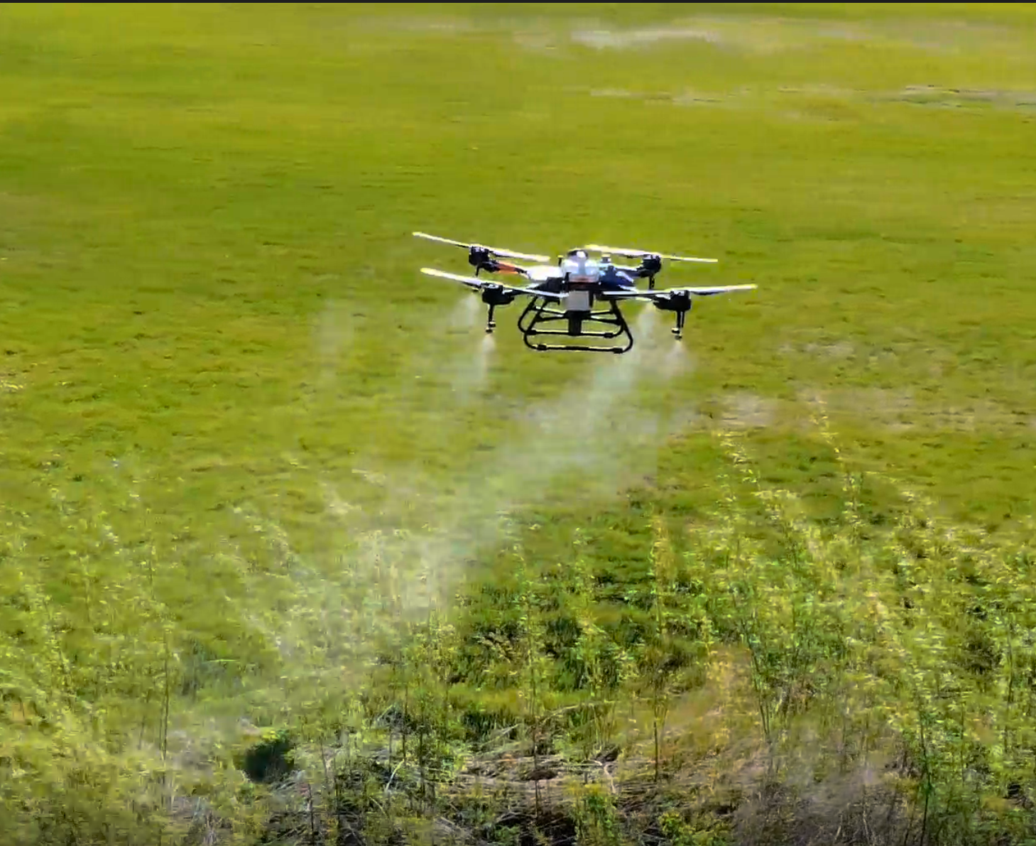
Similar to what the stormwater drone pilots have found, using drones for herbicide application helps staff reach areas that normal equipment, like truck-mounted or tractor-mounted sprayers, can't reach easily. Spraying non-native phragmites, an invasive reed grass that can reach 15 feet tall, can be a challenge. Not only can the drone target these tall plants better, but the downward propwash from the propellors drives the herbicide further into the plant.
“The propwash makes for a better kill rate with the tall plants,” said Sander, a TOS based in North Branch. “With regular herbicide application, you just drive by. With a drone, it's an 80 percent better kill rate with taller plants. It’s much more precise than the usual methods.”
Phragmites grow in wet areas. If left unchecked, they can crowd out native plants. Their size is only one of the challenges in trying to deal with them.
“In the past, I've been in rubber boots walking through swamps, trying to get to a location that has poison hemlock or phragmites,” said Anderson, a transportation generalist based in Mendota. "Flying over something is a safer way to apply herbicide rather than walking to it. On foot, for big patches you have to walk into the phragmites to get to the middle where you can't even see over them. The drone is much safer and more effective.”
Getting out on foot is only part of the problem. The typical, tractor-based approach to weed control involves scheduling equipment, transporting a tractor to the site, and then moving it on to the next thing. With a drone, the team can simply bring a trailer and go. It takes “next to nothing to move it around,” said Ahr, a Hastings-based transportation generalist working summer months in the west metro.
Future plans call for bigger drones, which require Federal Aviation Administration approval. While this can allow for drones that weigh up to 1,350 pounds, the ideal weight for what these herbicide pilots need would be around 80 pounds, Ahr said.
A University of Idaho drone pilot program could also point the way to new capacities in the future. The program is testing scout drones that can do a preliminary pass over an area to identify invasive plants and mark them for herbicide targeting. Once this is done, the herbicide drones can fly a pre-programmed flight path and spray in the right areas, saving both time and materials.
Some of that pre-programming is happening already. The MnDOT herbicide drones can operate within pre-defined border areas and have automatic object collision avoidance. They also automatically return to a landing site when they need new batteries or herbicide refills. Replenished, the drones pick up where they left off.
“When on its own, it's almost like a tractor using GPS,” Ahr said. “It never hits the same spot twice.”
